GeoDigiPract
Within the program activity “Development of higher education” of the Ministry education, science, and technological development for the school year 2021/2022 year, the project was recognized “Implementation of digital competencies and further training of geography teachers through teaching practice” (GeoDigiPract). The project holder is the Faculty of Science, Department of Geography, Tourism and Hotel Management, and the project manager is prof. Dr. Ljubica Ivanović Bibić, and the members of the project team are prof. dr Anđelija Ivkov Džigurski, prof. Dr. Lazar Lazić, prof. Dr. Smiljana Đukičin Vučković, Dr. Jelena Milanković Jovanov.
The main goal of the project is the implementation of acquired knowledge and further development of digital competence of students / future teachers who are in the school year 2020/2021 years on basic academic studies were involved in the implementation of the DIGinGEOteach project and improvement of existing methodological subjects in master studies, as well as connecting theory and internships involving students in working with teachers in primary and secondary schools, for greater acquisition and application of practical knowledge.
Teacher mentors from schools who would be involved in the project can with the help of digital applications to show students on practical examples that in addition to running the school documentation, can post work and supplementary material to students.
It represents a special benefit in the realization of the project and in university teaching the possibility of using the Internet on the campus of the University, outside the classrooms, allowing students (through distance learning simulation) train to work in different conditions from those in classrooms. In this way, teaching can be realized in the open, which certainly is represents a more challenging, exciting, and different kind of experience that will help them gain knowledge from the given contents.
All of the above will be realized through the obligatory subjects Methodology of Geography Teaching 2 and the application of didactic principles in the teaching of geography, while within the subject Curricula in the world and in our country students are acquainted with experiences from other countries and opportunities to connect with colleagues from the environment, but also from around the world through various networks (on for example, involving students in the work of online school communities or teachers, for exchange experiences).
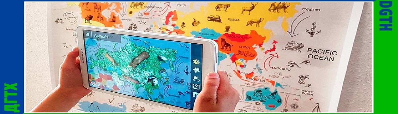
Within the subject, Basics of Photography as a Graphic Means in Geography students will acquire knowledge about the basics of photography, and its successful application in geography.
They will get acquainted with the types and techniques of working with the camera, and the technology of working with digital cameras. They will get acquainted with the use of light and the use of compositional techniques.
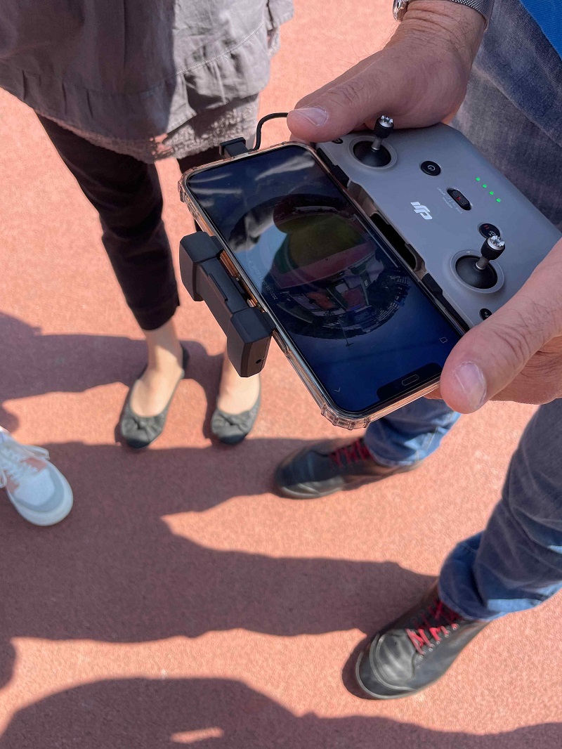
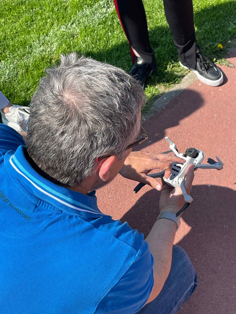
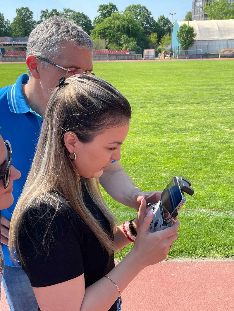
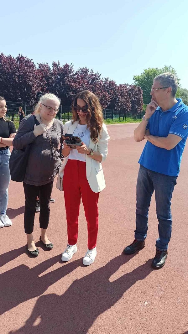
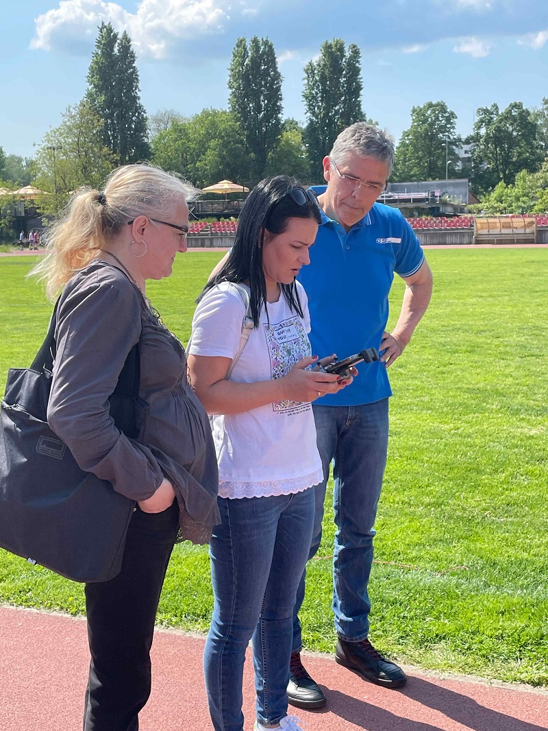
They will master the characteristics and ways of photographing nature (living world), landscapes, people, objects architecture. They will get acquainted with the basic techniques of computer photo processing software. They will learn how to use a drone for the purpose of making recordings in the function of teaching geography. He will master the basic techniques of drone flying and the ways of framing geographical ones objects from the above perspective.
Through practical work of students with students in high schools, within the subject School practice 2, will insist on the implementation of all acquired knowledge from previous courses, and that:
- In a real environment, ie in a geography classroom, and
- Through distance learning, which will fully meet modern requirements educational work in schools in the Republic of Serbia.
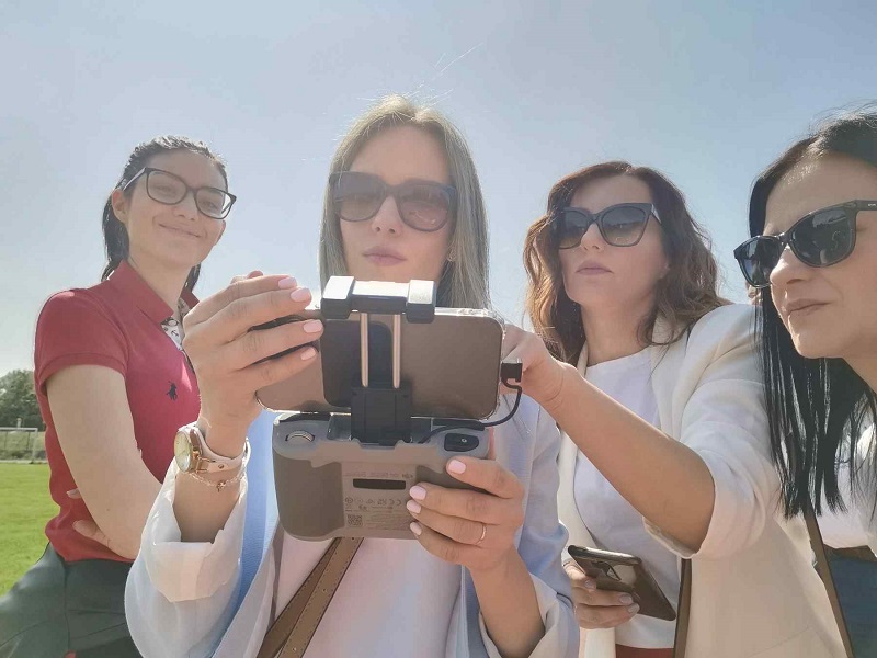
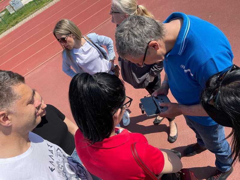
Within the project “Implementation of digital competencies and further training of geography teachers through teaching practice” (GeoDigiPract), project members, together with master’s students, did a short training and exercise in working with drones. On that occasion, prof. Dr. Lazar Lazić demonstrated numerous possibilities of work and application of drones in geography teaching. Students and members of the project were introduced to the use and basic functions of the drone, after which they all had the opportunity to try out the basic functions of drone control. This additional skill will certainly help students, and future geography teachers in their work and increase digital competencies, which is the main goal of the GeoDigiPract project.