
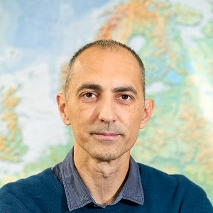
Minučer Mesaroš
Short biography:
Year and place of birth: 1976., Subotica
Graduated in 2001 as Professor of Geography, at the Department of Geography, Tourism and Hotel Management, Faculty of Sciences, University of Novi Sad. PhD thesis entitled Spatial Analysis of Geohazard on The Fruška Gora Mountain was defended in 2013 at the University of Szeged, Faculty of Sciences and Informatics, Department of Physical Geography and Geoinformatics with the grade Summa cum laude.
Contact:
Tel: +381 21 450 602 | e-mail: For students: geoinfons@gmail.com, minucer.mesaros@dgt.uns.ac.rs | minu@uns.ac.rs
Consultation hours 2019/2020 (WINTER SEMESTER October 1, 2019 – January 15, 2020): Thursday 11-13:30, GIS 1, 1st floor
Linkedin https://rs.linkedin.com/in/minučer-mesaroš-39591769
https://www.researchgate.net/profile/Minucser_Meszaros
https://twitter.com/MinuMesaros
Academic titles:
- 2019 – Associate Professor
- 2014 – Assistant Professor, Department of Geography, Tourism and Hotel Management, Faculty of Sciences, University of Novi Sad
- 2008 – Research Associate, Department of Geography, Tourism and Hotel Management, Faculty of Sciences, University of Novi Sad
- 2004 – Research Trainee, Department of Geography, Tourism and Hotel Management, Faculty of Sciences, University of Novi Sad
- 2002 – Professional Associate, Department of Geography, Tourism and Hotel Management, Faculty of Sciences, University of Novi Sad
- 2000 – Laboratory Assistant, Department of Geography, Tourism and Hotel Management, Faculty of Sciences, University of Novi Sad
Education:
2013 – Doctor of Geosciences, Department of Physical Geography and Geoinformatics, Faculty of Sciences and Informatics, University of Szeged.
2001 – Professor of Geography, Department of Geography, Tourism and Hotel Management, Faculty of Sciences, University of Novi Sad
Research field:
- Geoinformatics
- Geographic Information Systems (GIS)
- Interdisciplinary research
Other important information:
- Foreign language skills: Hungarian, English, German
- Membership in organizations: European Geosciences Union (EGU), Serbian Geographical Society, branch Society of Geographers of Vojvodina
Teaching engagement
- Geographic Information Systems
- Introduction to Geoinformatics
- GIS Software
- Methods of geographical data analysis (teaching assistant)
- Application of GIS in environmental monitoring and protection
- Methods of geographical data collection and processing
- Planning and arrangement of geographical space in industrialized countries
Selected references and projects
- Basarin B., Lukić T., Mesaros M., Pavić D., Đorđević J., Matzarakis A. (2018): Spatial and temporal analysis of extreme bioclimate conditions in Vojvodina, Northern Serbia, International Journal of Climatology, Vol 38, Issue 1, 142-157. doi:10.1002/joc.5166 (M21)
- Manakos I., Tomaszewska M., Gkinis I., Brovkina O., Filchev L., Genc L., Gitas I.Z., Halabuk A., Inalpulat M., Irimescu A., Jelev G., Karantzalos K., Katagis T., Kupková L., Lavreniuk M., Mesaros M., Mihailescu D., Nita M., Rusnak T., Stych P., Zemek F., Albrechtová J., Campbell P. (2018): Comparison of Global and Continental Land Cover Products for Selected Study Areas in South Central and Eastern European Region, Remote Sensing, 10, 1967,doi:10.3390/rs10121967 (M22)
- Krmar M., Radnović D., Hansman J., Mesaros M., Betsou C., Jakšić T., Vasić P. (2018): Spatial distribution of 7Be and 137Cs measured with the use of biomonitors, Journal of Radioanalytical and Nuclear Chemistry, Volume 318, 3, 1845-1854. doi:10.1007/s10967-018-6121-9 (M23)
- Krašić, D., Groner, E., Mészáros M., Nikolić T., Radišić D., Milić S., Kebert M., Milić, D., Vujić A., Galić Z (2018): Riverine wood-pasture responds to grazing decline, Ecological Research, Vol 33, Issue 1, 213-223. doi: 10.1007/s11284-017-1540-6 (M23)
- Petrović M., Pavić D., Marković S.B., Mészaros M., Jovičić A. (2016): Comparison and estimation of the values in wetland areas: A study of ramsar sites obedska bara (Serbia) and lonjsko polje (Croatia), Carpathian journal of earth and environmental sciences, Vol 11, No 2, 367-380. (M23)
- Стојановић В., Павић Д., Месарош М. (2014): Ритови Бачке – географске карактеристике, исушивање, коришћење и заштита природе. Матица српска, Нови Сад, пп 112. (M42)
- Bjelajac D., Mészáros M., Schaetzl R., Pavić D., Micić T., Marković S., Gavrilov M., Perić Z., Marković S.B. (2016): Introducing the Loess Pyramid – an Unusual Landform in the Thick Loess Deposits of Vojvodina, Serbia,Geographica Pannonica, Volume 20, Issue 1, pp. 1-7 (M51)
- Armenski T., Stankov U., Dolinaj D., Mesaros M., Jovanović M., Pantelić M., Pavić D., Popov S., Popović Lj., Frank A., Ćosić Đ. (2014): Social and Economic Impact of Drought on Stakeholders in Agriculture, Geographica Pannonica, Volume 18, Issue 2, pp. 34-42 (M51)
- Mészáros M., Pavić D.,, Trifunov S., Srdanović M., Seferović S. (2014) Possibilities of applying CORONA archive satellite images in forest cover change detection – example of the Fruška Gora mountain, Geographica Pannonica, Volume 18, Issue 4, pp. 96-101 (M51)
- Milanković J., Pavić D., Đorđević J., Dragin A., Đukičin Vučković S., Mészáros M. (2018): The Danube inland waterway transport and its role in Serbia’s economic development, R-Economy Scientific Economic Journal, Volume 4, No 3., pp. 105-114 (M53)
- Marković J., Pavić D., Mészáros M., Petrović M. (2015) Measuring the Quality of the Lakeside Tourist Destinations: The Study of Lake Palić and Lake Srebrno (Serbia). Journal of Environmental and Tourism Analysis, Vol 3, No1, pp. 63–81. (M53)
- Improvement of drought and excess water monitoring for supporting water management and mitigation of risks related to extreme weather conditions WATERatRISK (HUSRB/1602/11/0057)
- Water shortage hazard and adaptive water management strategies in the Hungarian-Serbian cross-border region WAHASTRAT (IPA HUSRB/1203/121/130)
- Measurement, monitoring, management and RIsk assessment of inland EXcess Water in South-East Hungary and North Serbia (Using remotely sensed data and spatial data infrastructure) MERIEXWA (IPA HUSRB/1002/121/088)