
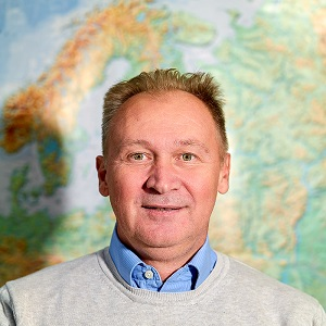
Branko Ristanović
Full Professor
Short biography:
Date and place of birth: April 22, 1969, Šabac. Graduated in 1996, completed his Master's in 2001, and defended his doctoral dissertation in 2004 at the Department of Geography, Tourism and Hotel Management, Faculty of Sciences, University of Novi Sad.
Contact:
Phone: +381 21 485 2836 | Email addresses: branko.ristanovic@dgt.uns.ac.rs; brankoris@yahoo.com
Consultation hours: Tuesday 10:00 AM–12:00 PM / Thursday 10:00 AM–12:00 PM
Academic ranks:
- Professional Associate, 1996, Faculty of Sciences, Novi Sad;
- Teaching Assistant Trainee, 1997, Faculty of Sciences, Novi Sad;
- Teaching Assistant, 2001, Faculty of Sciences, Novi Sad;
- Assistant Professor, 2005, Faculty of Sciences, Novi Sad;
- Associate Professor, 2010, Faculty of Sciences, Novi Sad.
Areas of scientific research:
- Cartography (analog and digital)
- Geology
- Hydrogeology
- Geomorphology
- Natural disasters and geohazards
Subjects:
- Basic academic studies: Cartography, Hydrogeology, Digital cartography, Field work and educational excursions
- Master of academic studies: Visualization of geographic data (Master of geoinformatics), Applied geomorphology (Master of geoecology)
Other important information:
- Foreign languages: English
- Membership in professional organizations:
- Serbian Geographical Society, branch Society of Geographers of Vojvodina,
- Serbian Water Protection Society
Engagement at other higher education institutions:
- From 2008 to 2012, lecturer in bachelor's and master's academic studies at the Faculty of Sciences, University of Tuzla (Bosnia and Herzegovina);
- In the 2018/2019 academic year, lecturer in doctoral studies at the Faculty of Sciences, University of Tuzla (Bosnia and Herzegovina).
Teaching engagement
- Cartography (analog and digital)
- Geology
- Hydrogeology
- Geomorphology
- Natural disasters and geohazards
Selected references and projects
- Ćurčić, S., Ristanović, B. (2014): Kartografija, Prirodno-matematički fakultet, Departman za geografiju, turizam i hotelijerstvo, Novi Sad, 162.
- Lukić, B., Ristanović, M., Milanović, Đ., Milјković (2018): Praktikum iz kartografije sa topografijom, pomoćni udžbenik, Univerzitet u Novom Sadu, Prirodno-matematički fakultet, Departman za geografiju, turizam i hotelijerstvo, Novi Sad, 82.
- Davidović, R., Milјković, Lj., Ristanović, B. (2003): Relјef Banata, Departman za geografiju, turizam i hotelijerstvo, Novi Sad, 188.
- Davidović, R., Milјković, Lj., Ristanović, B. (2005): Relјef Bačke, Departman za geografiju, turizam i hotelijerstvo, Novi Sad, 81.
- Ristanović, B., Bubalo Živković, M., Tanasić, J., Popović, A. (2016): Opština Krupanj – monografija, Opština Krupanj, Univerzitet u Novom Sadu, Prirodno-matematički fakultet, Departman za geografiju, turizam i hotelijerstvo, Novi Sad.
- Ristanović, B., Cimbaljević, M., Miljković, Đ., Ostojić, M., Fekete, R. (2019). GIS application for determining geographical factors on intensity of erosion in Serbian river basins. Case study the river basin of Likodra, Atmosphere, No. 10 (9).
- Milanović, T., Micić, T., Lukić, S., Nenadović, S., Basarin, B., Filipović, D., Tomić, M., Samardžić, I., Srdić, Z., Nikolić, G., Ninković, M., Sakulski, D., Ristanović, B. (2019). Application of landsat-derived NDVI in monitoring and assessment of vegetation cover changes in central Serbia, Carpathian Journal of Earth and Environmental Sciences, Vol. 14, No. 1, pp. 119–129.
- Miljković, Đ., Božić, S., Miljković, Lj., Marković, S.B., Lukić, T., Jovanović, M., Bjelajac, D., Vasiljević, Đ.A., Vujičić, M.D., Ristanović, B. (2018): Geosite Assessment Using Three Different Methods; a Comparative Study of the Krupaja and the Žagubica Springs – Hydrological Heritage of Serbia, Open Geosciences, No. 10, pp. 192–208.
- Lukić, A., Lukić, T., Basarin, B., Gavrilov, M.B., Marković, S.B., Milanović, M., Pavić, D., Miljković, Đ., Ristanović, B., Mesaroš, M., Dubovina, Z. (2018): Utilization of temperature–precipitation based aridity index in the Pannonian basin. Abstract book, International conference, Natural hazards – lessons from the past and contemporary challenges, Serbian academy of sciences and arts, University of Novi Sad, Department of geography, tourism and hotel management, pp. 45, Novi Sad.
- Ristanović, B., Lukić, T., Milanović, M., Miljković, Đ., Cimbaljević, M., Perić, Z. (2018): The determination of torrential flooding using GIS, a case study of the Likodra catchment basin (Western Serbia). Abstract book, International conference, Natural hazards – lessons from the past and contemporary challenges, Serbian academy of sciences and arts, University of Novi Sad, Department of geography, tourism and hotel management, pp. 53–54, Novi Sad.
- Dolinaj, D., Ristanović, B., Pavić, D., Stojanović, V., Pašić, M. (2008). Hydro-geological problems of Vranjaš accumulation (Vojvodina, Serbia). Geographica Pannonica, Volume 12/2, pp. 69–76.
- Stojić, B., Ristanović, B., Tanackov, I., Vesković, S. (2010): Modeling evaluation of the size of countries (regions) using fuzzy logic. Geographica Pannonica, Volume 14/2, Novi Sad, pp. 59–66.
- Ristić, Z., Marković, V., Barović, V., Ristanović, B., Marković, D. (2010): Application of GIS in re-introduction of deer in National Park Fruška Gora (Vojvodina, Serbia). Geographia Technica, No. 1, pp. 58–66, Timișoara.
- Geographical aspects of the state and development directions of Serbia (Vojvodina) (Project No. 1270). Ministry of Science and Technology of the Republic of Serbia, 2002–2005.
- Encyclopedia of Settlements of Serbia, Ministry of Science and Environmental Protection, 1998–2002.
- Encyclopedia of Vojvodina, Vojvodina Academy of Sciences and Arts, 2008–.
- Serbian Encyclopedia, Ministry of Science, Education and Technological Development, 2011–.