

")

LOESSFEST'09 | Aug. 31st – Sept. 3rd, 2009 |Novi Sad-Serbia
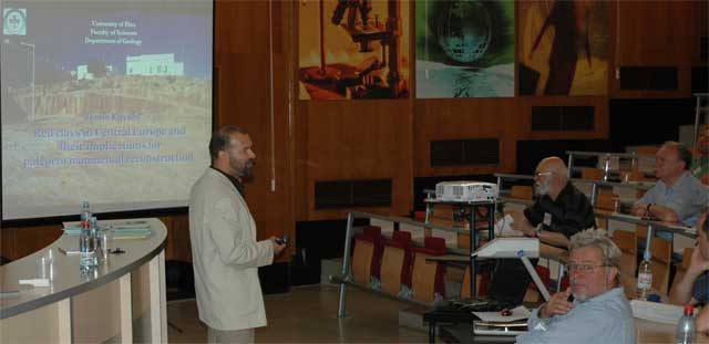
Red Clays and Reddish Paleosols in the Pannonian Basin: A Review
Janos Kovács, J.1
1Department of Geology, University of Pécs, H-7624, Pécs, Ifjúság u. 6, Hungary
Terrestrial red clays underlying Quaternary loess deposits, or filling fissures and recently existing caves in limestone are called Tengelic Red Clay Formation (Middle Pliocene to Lower Pleistocene). The red clay in Hungary is overlain by loess paleosol sequences. The thickness of the red clay ranges from 4 to 90 m. The Hungarian red clays had been recognized by Lóczy (1886), but research on them was subsequently intermittent. Different views on the formation, properties and distribution of red clays have been published. Early scientists described the red clay as a variety of loess, sediment formed by the deposition of wind-blown silt (Lóczy, 1886; Sümeghy, 1944).
The main problems of terrestrial paleoclimate reconstructions are the completeness of the core material and a sampling resolution. To detect single dust storms we use a particle detection method, which allows high resolution, sub-annual analyses of sediment structures in undisturbed samples. The ELSA (Eifel Laminated Sediment Archive) stack is a compilation of four different lake sediment cores of the Eifel region (Western Germany) and comprise the period of the last 133 ka.
The red clay sediments in the Carpathian Basin are known from both exposures and boreholes. The investigated sections selected for this study are located mainly in the foothills of Hungarian mountains except the central part. The age of the Tengelic Red Clay Fm. is ~3.5–1.0 Ma (Gyalog and Budai, 2004).
The second dataset, the ELSA wind direction reconstruction depends on provenance analyses of wind transported carbonates. This continuous record over the period 40.3-12.8 ka has an original sample interval of 500 μm, which is equivalent with a mean time resolution of about four month. To calculate the east wind activity for a fixed 100 years interval, all single 500 μm segments that show east wind activity are summed after the time correlation procedure.
The underlying (Miocene–Lower Pliocene) strata are generally composed of thick greyish-yellow, mica-rich, cross-bedded sand, and sandy clay or sometimes limestone. In the mountain areas of the northern part of the country red day occurs on karstic limestone areas as depression and cave fill. Jámbor (2001) considers that this clay was formed during the Early Pleistocene, or possibly even prior to the Quaternary. Also in the northern part of the country, but on the southern foothills on the mountains, the lower part of the sand bed bears different fossils (animals, plants), sometimes between sandstone benches. The cross bedded sand or sandy clay is overlain by a 3–20 m thick red clay horizon. The thickness of this horizon is about 3 to 6 m in the northern and southern part of the country. In the central part (especially in boreholes) this thickness is much bigger (10– 20 m or more). Red clay (5 YR 5/6) displays prismatic structure with slickenside, stress surfaces and brown and yellowish spots. CaCO3 nodules, 3–5 cm in diameter, occur in the lower part of the red clay. Generally, the colour of the lower part is lighter than that of the upper part. Black Fe–Mn stains are generally abundant throughout the entire red clay unit, which is covered by Quaternary loess-paleosol sequence. In the southern mountainous part of the country red day occurs as fissure and karst cavity fill in limestone.
In extensive areas of Central and SE Transdanubia and in certain occurrences E of the Danube river the lower part of the Pleistocene is represented by the Tengelic Red Clay Formation which is made up of red and variegated clay, sand and silt of fluvial facies. It is underlain unconformably by Upper Pannonian or older deposits and normally covered by loess.
Loess is widespread in the alluvial plains and to a lesser extent on the slopes of the mountainous areas as well; however, it reaches its widest extent and greatest thickness in the hilly regions of Central and SE Transdanubia (Jámbor, 2001). Loess is wind-blown sediment of silt size formed in the periglacial areas during cold and dry periods of the Pleistocene. It may have transitions to, or may alternate with, eolian sand deposits. Loess sequences can be interrupted by paleosol horizons formed during the milder interglacial periods. In the hilly and mountainous regions the loess complex is called the Paks Loess Formation, which is underlain in SE Transdanubia by the TRCF. According to Jámbor (1997) loess was formed in the hilly regions during the time span of 1.2 Ma to 12 ka.